

Severe Flooding Devastates NSW
Unprecedented Rainfall Triggers Crisis
Relentless rainfall has slammed New South Wales, especially the Mid North Coast and Hunter regions. Some areas received over 200 millimeters of rain in less than 24 hours. Taree alone recorded 412mm in two days—five times its monthly average for May.
The Bureau of Meteorology (BOM) attributes this extreme weather to a slow-moving coastal trough near Coffs Harbour. This system has lingered since Monday, May 19, 2025, unleashing heavy rain across the region.
The trough intensified into a low-pressure system, which created a multi-day weather event. It soaked the soil and caused rivers to overflow.
The deluge caught many communities off guard. Earlier showers over nine consecutive days had already saturated the ground, making rapid flooding more likely.
Authorities warn that the wet ground causes even moderate rain to flow straight into rivers and streams. This sharpens the flood risk dramatically.
Widespread Flooding and Evacuations
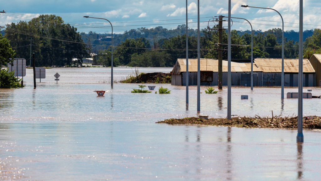
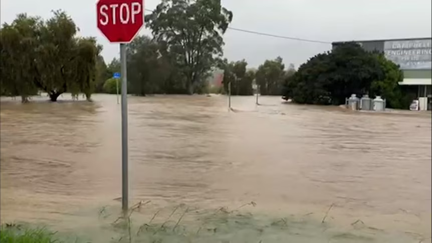
Floodwaters have swamped towns across the region. Taree, Wingham, Dungog, Gloucester, and Bulahdelah are among the worst affected. The Manning River at Taree surged to its highest level in nearly a century, breaking the 1929 record of six meters. This record-breaking rise forced emergency evacuations.
The State Emergency Service (SES) issued multiple emergency warnings. They told residents in low-lying areas like Taree’s Dumaresq Island and Kempsey CBD to evacuate immediately.
Floods trapped dozens of people. SES crews rescued nearly 300 people in the Mid North Coast alone.
Around 16,000 residents may become isolated as floodwaters cut off roads and bridges. Water has blocked the Pacific Highway at North Taree, leaving some areas unreachable.
Authorities have issued major flood warnings for the Manning, Hastings, Gloucester, Paterson, and Williams rivers. Moderate flooding stretches from Newcastle to Port Macquarie. Officials urge people to stay inside and avoid driving through floodwaters.
Infrastructure Damage Across Regions
Extreme weather has knocked out power and disrupted transit systems. Over 4,000 homes on the Mid North Coast and 400 more in Newcastle lost electricity. Essential Energy will conduct aerial patrols to inspect damage around Taree.
The SES says constant rain and blocked roads make power restoration difficult.
Flooding and equipment damage have crippled transit networks. The Hunter rail line has shut down between Newcastle Interchange, Scone, and Dungog due to water damage and wiring issues.
Authorities have replaced trains with buses on the Central Coast and Newcastle lines. Flooded sections of the Pacific Highway, including Manning River Drive and Jericho Road, remain closed. These closures isolate many communities and complicate rescue operations.
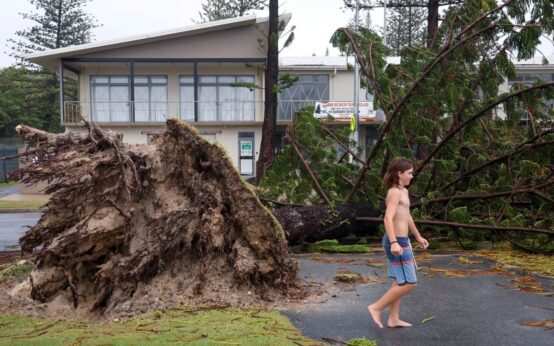
The BOM warns that the waterlogged ground could trigger landslides. Such incidents may worsen infrastructure damage.
More Severe Weather Ahead
The BOM forecasts more rain through at least Thursday, May 22, 2025. The system could drop another 50mm to 150mm, with isolated areas seeing over 200mm.
The coastal trough is shifting northward. It now brings heavy rain to the Coffs Coast and Northern Tablelands.
Flash flooding remains a serious risk, especially in high inland areas north of South West Rocks.
Hazardous surf conditions are hitting the coast, with waves reaching five meters. Places like Wamberal on the Central Coast face rising coastal erosion.
The SES warns that swollen rivers can’t handle more water. Continued rain could trigger more flooding. Officials urge everyone to follow weather updates and prepare for possible evacuations.
Community Impact and Response
Flooding has devastated communities. It has destroyed homes and caused major losses. In Bulahdelah, one resident said rising water from the Myall River swept away their houseboat.
Dangerous conditions have shut down 31 schools across the Mid North Coast, Hunter, and Central Coast.
The SES and Rural Fire Service (RFS) continue working day and night. RFS teams responded to flood rescues and storm damage throughout the night.
Despite the destruction, some inland farmers in the Murray Basin may welcome the rain. It could bring long-needed drought relief as the system moves south.
For now, the focus remains on rescue and recovery. The SES urges people to take warnings seriously and avoid entering floodwaters to prevent more loss of life or property.
 What’s New in Australia’s International Student Policy?
  Labor Party to Holds Power in Australia
 Alfred Cyclone Weakens, but flood threat looms
 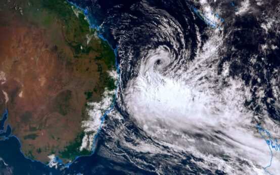 Alfred Cyclone: Australian Government told to prepare for worst
  Champions Trophy: India reaches final